
 ISLAMABAD, May 17: Pakistan and India on Thursday exchanged maps of Sir Creek, marked with their respective claims over the marshy strip as well as maritime boundary in the area.
The maps were exchanged when the two sides began a two-day meeting here on Thursday to resolve their longstanding dispute over the 96-km estuary in the Rann of Kutch separating India's Gujarat from Sindh.
Official sources said that the two sides would study the maps and discuss their viewpoints on each other's claims and then convey the outcome to their respective governments.
This was the first formal round of talks on Sir Creek under the fourth round of composite dialogue after the two countries conducted a joint survey and agreed on a common map of the marshlands that will help demarcate maritime boundary between them.
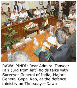
Surveyor-General of India Major-General M. Gopal Rao, who is leading an eight-member Indian delegation, and Additional Defence Secretary Rear Admiral Tanveer Faiz, who is leading the Pakistan delegation, also exchanged maps with their respective demarcations of the maritime boundary.
The sources said that many convergences were apparent between the two sides in this second set of maps.
The two sides would explain the basis for their respective claims of the boundary on the 96-km creek when the talks resume on Friday.
Unlike the Siachen issue, over which the two sides could not make much headway when they held talks last month, Sir Creek is being increasingly seen by both sides as doable.
Some basic differences, however, continue to dog negotiations over the issue. India asserts that the Sir Creek boundary lies in the middle of the channel whereas Pakistan claims that it is on the east bank.
The joint survey of Sir Creek by hydrographers from India and Pakistan, which formally began in January, was conducted on land and off the coast to verify the outermost points of the coastline based on the principle of equidistance. The survey was completed around mid-March.
During their meeting in Havana in September 2006, Prime Minister Manmohan Singh and President Pervez Musharraf had directed experts to meet immediately and coordinate a joint survey of Sir Creek and adjoining area, without prejudice to each other's position.
A resolution to the Sir Creek issue could enable the two countries to notify their EEZ spanning to several hundred miles in the sea.


