
Pakistan’s Ground Zero
GILGIT-BALTISTAN has emerged as Pakistan’s climate ground zero. For decades, the country’s climate emergency was narrated from its floodplains: Sindh’s submerged villages, Punjab’s swollen tributaries, the 2010 and 2022 disasters. These were the consequences of a deeper story. The origin has abruptly moved upstream. GB is no longer the water tower that occasionally leaks. It is where the Indus system’s first disasters now begin, not where they arrive.
Heatwaves once confined to Sindh’s cities and Punjab’s plains now reach the Upper Indus Basin (UIB). In June 2026 alone, the Met Office issued its second Glof (glacial lake outburst flood) alert of the month, warning that sustained high temperatures across GB and KP were accelerating glacier and snowfield melt to the point that existing lakes were expanding and new ones forming in real time.
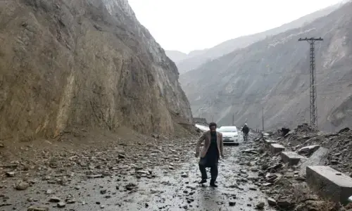
This follows a pattern of near-annual escalation: in August 2025, a Glof from the Shishper glacier tore through Hassanabad Nullah in Hunza, severing the Karakoram Highway, in the highest-volume event since 2018. Each year now sets its own benchmark.
Underneath the visible flooding sits a less visible mechanism. Central Karakoram’s glaciers are not simply shrinking the way the Himalayan glaciers to their east are; some have been stable or even advancing since 1990 — a documented anomaly.
But stability at the surface has not meant stability underneath. Meltwater cuts channels through the ice itself, moving downward by gravity, forming englacial tunnels that destabilise glaciers from within even where their outward mass looks intact.
That is why river discharge from central Karakoram basins rose through 1985-2010 even as the glaciers appeared, by satellite, to hold steady. The lakes are the visible symptom; the tunnels are the mechanism; community displacement is the result. Pakistan currently counts 3,044 glacial lakes, with some 36 formally classified as hazardous and likely to affect over 7.1 million people.
Precipitation is changing structurally, in step with temperatures. Snow consolidates into firn, and firn into ice, a process called firnification, but now there’s less time for the process: more runs off as meltwater first, so the basin draws down its snowpack faster than it replenishes. High-altitude western UIB stations like Shendure, Yasin, Ziarat, Rattu, Chilas and Shigar, show a statistically significant rise in monsoon precipitation at elevation.
Climate models project the monsoon extending north and northwest into the UIB, with a rising share of the basin’s precipitation falling as rain rather than snow. The monsoon, once a lowland event arriving after the high-altitude melt season had run its course, is beginning to overlap it. Rain on an already melting snowpack accelerates run-off.
We have a flood regime that no longer respects Pakistan’s disaster-response calendar.
The consequence is a flood regime that no longer respects Pakistan’s disaster-response calendar or its fourth national flood protection plan (2018-2028). Glofs and monsoon floods, once sequential risks with distinct seasons and targets, are becoming concurrent and compounding, a different planning problem entirely.
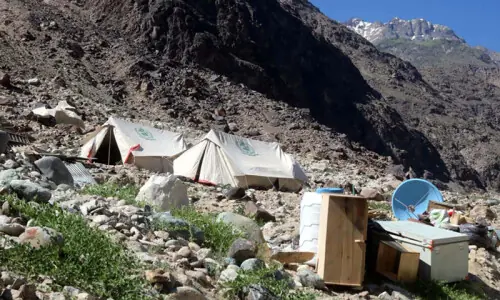
Debris and mudslides change the underlying ecology in ways ordinary flooding does not: a riverine flood leaves silt, while a flow carrying boulders and glacial till causes irreversible loss and damage to the ecosystem. Buner and Lower Dir showed this in August 2025, when flash floods carried boulders flattening neighbourhoods and leaving survivors standing on rubble that used to be farmland.
There is ‘non-economic loss and damage’, the central pillar of the global loss and damage discourse. It shows up in the erosion of proud local heritage of grafting glaciers. GB is home to more than 50 languages and dialects, including Domaaki and Wakhi, classified by Unesco as critically endangered, and Burushaski, a language spoken nowhere else on earth. These survive orally, in valleys now being depopulated by flood damage and outmigration, so every displaced household moves further from the people who still speak the language at home.
The same is true of the region’s archaeological record: more than 50,000 petroglyphs, some dating to 5,000 BC, line the Karakoram Highway corridor between Hunza and Shatial, carved by the traders and pilgrims who passed through GB on the Silk Route. The 2022 floods destroyed a significant share of the inscribed rock surfaces at the Thalpan site near Chilas. What remains is not protected by any Unesco listing. It is protected by distance and isolation, both of which are now being removed.
GB is not the first place in the Himalayan region to witness this kind of disaster, and need not build its response method from scratch. On June 15, 2021, a glacial lake called Pemdan in Nepal breached in the Melamchi-Indrawati watershed north of Kathmandu. The breach destabilised a landslide dam downstream; the combined debris flow, over 10 metres deep in places, displaced hundreds of people and severed the water supply serving much of Kathmandu.
Research at ICIMOD has argued that no single hazard model would have caught it: reconstructing the event required integrating satellite data, hydrodynamic modelling, and machine learning to trace how the outburst, the dam failure and the rainfall interacted.
In GB’s case, a compound hazard is two risks overlapping in time — monsoon rainfall coinciding with the melt season. A cascading hazard triggers the next in sequence: a heatwave leading to Glof and then debris flow, which causes displacement, outward migration, eroded livelihoods and a shortened tourism season central to GB’s cash economy. Melamchi was both at once, and so is GB now.
Response infrastructure is becoming maladaptive: 250 engineering structures and 284 early warning systems installed across GB and KP since 2017, built against a threat that arrived in one form at a time. It is now being asked to hold out against two or more hazards and needs to scale to the pace of lake formation rather than trail it.
Clearly, hazard modelling needs to move towards the joint, cascade-aware approach rather than treating Glofs, monsoon shifts and landslide risks as separate problems for separate agencies. The alternative: keep treating GB’s disasters as remote and isolated events, until the water arrives.
The writer represents Pakistan on the Board of Fund for Responding to Loss and Damage.
Published in Dawn, July 16th, 2026