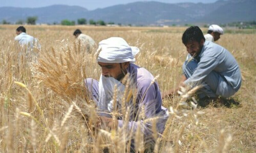
ISLAMABAD: The Food and Agriculture Organisa­tion (FAO) of the United Nations has taken steps to develop expertise and capacities of Geographic Information System (GIS) professionals in Pakistan for agricultural mapping and for land monitoring.

FAO took the steps with the recent availability of ‘Google Earth Engine’, a cloud-based computing geospatial platform which has gained the attention of remote sensing based applications.

The remote sensing based applications are designed to process large data sets for global applications, analysis and ultimate decision-making.

A 10-day virtual course on Google Earth Engine and its application for agricultural mapping and for land monitoring has now concluded in collaboration with the Geospatial unit at FAO headquarters in Rome.

Published in Dawn, December 31st, 2020

Opinion

Editorial

Hasty transition
Updated 05 May, 2024

Hasty transition

Ostensibly, the aim is to exert greater control over social media and to gain more power to crack down on activists, dissidents and journalists.
One small step…
05 May, 2024

One small step…

THERE is some good news for the nation from the heavens above. On Friday, Pakistan managed to dispatch a lunar...
Not out of the woods
05 May, 2024

Not out of the woods

PAKISTAN’S economic vitals might be showing some signs of improvement, but the country is not yet out of danger....
Rigging claims
Updated 04 May, 2024

Rigging claims

The PTI’s allegations are not new; most elections in Pakistan have been controversial, and it is almost a given that results will be challenged by the losing side.
Gaza’s wasteland
04 May, 2024

Gaza’s wasteland

SINCE the start of hostilities on Oct 7, Israel has put in ceaseless efforts to depopulate Gaza, and make the Strip...
Housing scams
04 May, 2024

Housing scams

THE story of illegal housing schemes in Punjab is the story of greed, corruption and plunder. Major players in these...