• PM hails map as first step towards resolution of Kashmir dispute
• Region’s description changed to Indian Illegally Occupied J&K
ISLAMABAD: The government on Tuesday unveiled a new political map of the country essentially asserting its longstanding position on Kashmir and Sir Creek disputes.
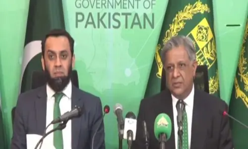
“It is a historic occasion. The political map reflects our national aspiration and supports our principled stance on Kashmir dispute,” Prime Minister Imran Khan said while introducing the map. He was on the occasion accompanied by his foreign policy, national security and information ministry aides.
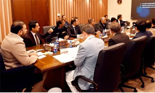
The map was launched after the approval by the federal cabinet. Foreign Minister Shah Mehmood Qureshi had earlier in the day briefed the legislators from opposition parties on the map during a meeting at the Foreign Office.
The new map was made public a day before Pakistan observes the first anniversary of annexation of occupied Kashmir.
India had annexed the held territory on Aug 5 last year by revoking articles 370 and 35A of its constitution, which had provided special status to occupied Kashmir and rights and privileges to Kashmiris.
The inauguration of the new map is, moreover, believed to be a response to India, which launched its own political map on Oct 31 last year after bifurcation of the disputed territory into so-called Union Territories of Jammu and Kashmir and that of Ladakh. India had through its map claimed the entire disputed area, including Azad Kashmir and Gilgit-Baltistan, as part of its territory.
The Indian map was on that occasion rejected by China, Pakistan and Nepal.
PM Khan hailed the new map as the “first step” towards resolution of the nearly 73-year-old dispute. He, however, emphasised that Pakistan believed in a political solution to the dispute. He said the map rejected India’s illegal action of annexing held Kashmir.
Foreign Minister Qureshi, on this occasion, gave a presentation on the features of the new political map. He said the map clearly showed the disputed area, whose status Pakistan wanted to be decided in accordance with the UN resolutions and aspirations of the people of held Kashmir.
“It is first time that the aspirations of Pakistani nation and our stated position on the dispute are being given with such clarity,” he maintained.
Special Assistant to the Prime Minister on National Security Moeed Yusuf, while talking to Dawn later, said the map asserted Pakistan’s claim on the territory, but had in no way suggested that the region was part of Pakistan. “We have just said that the dispute has to be resolved in accordance with UN resolutions,” he added.
Entire Gilgit-Baltistan and Kashmir had been given in the same green colour to show that it’s one territory, Mr Yusuf said, adding that the map also showed the changed nomenclature.
The government has changed the description of occupied region from Indian Occupied Jammu and Kashmir to Indian Illegally Occupied Jammu and Kashmir. It has been further clearly stated on the map that the region is disputed territory, whose “final status is to be decided in line with relevant UNSC resolutions”.
Mr Yusuf said the international boundary on the eastern side had been extended up to the undefined frontier to demarcate Indian territory of Himchal Pardesh from the disputed part of Jammu and Kashmir.
‘Frontier Undefined’ is another description that has been added to the map.

Mr Yusuf said it annotated that it would be defined after the Kashmir dispute was settled.
The claim on Junagadh and Manavadar too has been underscored. Moreover, an administrative boundary separating AJK and GB has also been inserted in the map.
Foreign Minister Qureshi at the ceremony held to inaugurate the map said the Line of Control had been extended and connected with the Chinese border. “This makes it clear that Siachen is ours,” he maintained.
An official, meanwhile, explained that the new map represented the position on Sir Creek, according to Sindh government’s agreement with the State of Kutch in 1914, demarcating the boundary on the Eastern Bank of Sir Creek.
Mr Qureshi said it negated Indian position with regards to Sir Creek. “India was cleverly trying to occupy hundreds of kilometers of our Exclusive Economic Zone,” he added.
The new map furthermore shows erstwhile Fata as part of Khyber Pakhtunkhwa province. Fata was merged with KP in May 2018 after 25th Amendment to the Constitution.
Indian reaction
Indian Ministry of External Affairs rejected the map as an “exercise in political absurdity, laying untenable claims to territories in the Indian State of Gujarat and our Union Territories of Jammu & Kashmir and of Ladakh”.
A statement issued from New Delhi said: “These ridiculous assertions have neither legal validity nor international credibility.”
FO response
The Foreign Office categorically rejected the statement made by the Indian external affairs ministry on Pakistan’s political map. “Through sophistry and obfuscation, India cannot create a smokescreen for its illegal and unacceptable actions in Indian occupied Jammu & Kashmir, including those taken since Aug 5, 2019. It is preposterous for a country that is compulsively expansionist, and a brazen practitioner of state-terrorism, to level charges against others,” the FO spokesperson said in a statement.
It said India had been in illegal occupation of parts of Jammu & Kashmir since 1947 and had continuously violated UN Security Council resolutions for decades. Despite its brutal suppression of Kashmiris for over 72 years, India had been unable to force them into submission, it added.
“Pakistan’s position remains clear and unambiguous. The solution of the Jammu and Kashmir dispute lies in the realisation of the Kashmiris’ inalienable right to self-determination through a free and impartial plebiscite under the auspices of the United Nations. The government, leadership and people of Pakistan remain firmly committed to the solution of the Jammu & Kashmir dispute in accordance with the relevant UN Security Council resolutions and the wishes of the Kashmiri people. The political map issued by Pakistan emphatically reaffirms this abiding commitment,” the FO said.
Published in Dawn, August 5th, 2020


