
Powerful El Nino could become strongest on record, WMO warns
• Phenomenon expected to peak by end of this year, disrupt weather patterns into 2027
• Sea surface temperature could peak at 3.6°C above average
• UN launches $110m emergency appeal; agency’s chief warns world is in danger zone
• Rare trio of Pacific hurricanes emerges as warm waters fuel storms
GENEVA: El Nino is forecast to be the strongest since comparable records began four decades ago, the United Nations’ climate agency warned on Thursday, with the UN chief saying the world was in the “danger zone of extreme weather”.
The weather phenomenon is set to become “very strong” in the months ahead and is near certain to persist through to February, the World Meteorological Organisation said.
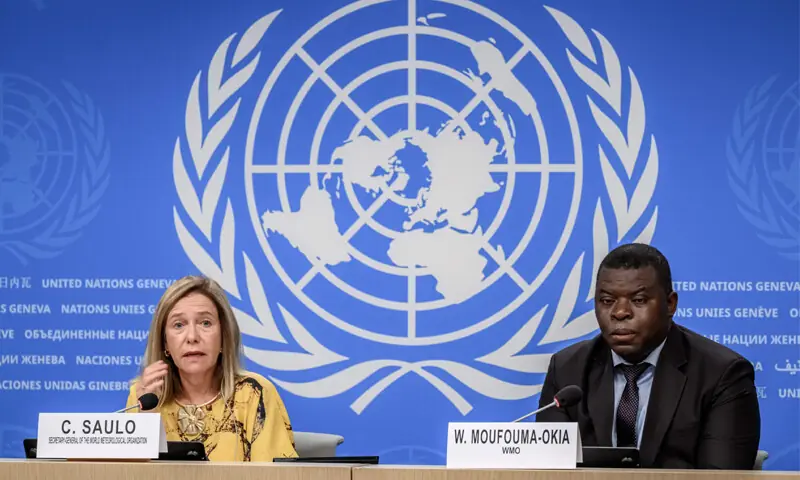
“If this trajectory continues, it may be stronger than anything since our monitoring began,” WMO chief Celeste Saulo said.
The current El Nino has a 69 per cent chance of becoming the strongest on record, according to the National Oceanic and Atmospheric Administration.
El Nino will peak toward the end of this year, though its knock-on impacts for the climate will continue well into 2027, according to the WMO. The phenomenon warms surface temperatures in the central and eastern equatorial Pacific Ocean, bringing worldwide changes in winds, pressure and rainfall.
The powerful 2023-24 El Nino contributed to 2024 being the warmest year on record, and “we should not be surprised if this record is broken”, Saulo added.
While El Nino is a naturally occurring phenomenon, scientists expect it will exacerbate the heat of a planet already warming from burning fossil fuels.
“El Nino is being supersized before our eyes,” UN Secretary General Antonio Guterres said. “The science leaves no room for doubt: the planet is in uncharted waters, and those waters are heating up.”
To prepare, the UN’s International Organisation for Migration appealed on Thursday for $110 million to protect 4.9m people from potentially severe impacts.
Wilfran Moufouma-Okia, the WMO’s climate prediction chief, noted the average forecast points toward a sea surface temperature anomaly peaking at 3.6 degrees Celsius above average — higher than the last two very strong El Ninos in 1997-98 and 2015-16.
“That category is open: we know where it starts; we don’t know where it ends,” Moufouma-Okia said.
Trio of hurricanes
Already, a rare trio of hurricanes was churning through the Pacific Ocean on Thursday, which scientists attributed to waters warmed by this historically strong El Nino.
Tropical Storm Marie strengthened into a hurricane late on Wednesday off the coast of Baja California, lining up behind Hurricanes Karina and Lowell — both rated as major Category 4 storms — which were making their way westward.
Three tropical cyclones are “definitely rare to see”, said Julia Cole, a climate scientist at the University of Michigan.
“El Nino warming sets the stage for these storms, which are fuelled in large part by warm waters — when the tropical Pacific is warmer than normal, we see an increase in strong storms,” Cole said.
Lowell was about 450 miles south of Hilo, Hawaii, and is expected to remain a major hurricane for several days, according to the National Hurricane Center.
Swells from Lowell are likely to cause life-threatening surf and rip current conditions in portions of the Hawaiian Islands, which are still recovering from last month’s Hurricane Lala.
Published in Dawn, September 4th, 2026