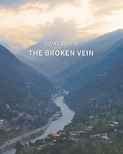

Swat basin faces over 5°C warming by century’s end

ISLAMABAD: A glacier risk assessment of the Swat watershed has warned that the basin is expected to warm by more than 5°C by the end of the century, particularly between October and June.
Winter rainfall is expected to change little, but summer rainfall could more than double under some climate scenarios, according to the assessment carried out by the Green Climate Fund (GCF), with support from the Asian Development Bank (ADB).
The changes are likely to increase the risk of severe floods and erosion, cause a short-term rise in water availability due to glacier melt and runoff, and lead to long-term declines as glaciers continue to recede, according to the assessment made available on Wednesday.
The Swat basin, which has more than 10,000 glaciers, faces an increased risk of infrastructure failure and resulting floods. The assessment also warned of agricultural losses, erosion in valley areas, and a short-term water surplus followed by a long-term deficit.
The GCF has conducted glacier risk assessments for four representative watersheds: Kura (Armenia, Azerbaijan and Georgia), Naryn (Kyrgyz Republic, with downstream links to Kazakhstan and Uzbekistan), Pyanj (Tajikistan, Turkmenistan and Afghanistan) and Swat (Hindu Kush-Karakoram-Himalaya).
The four pilot basins capture diverse glacier and hydrological conditions across Central and West Asia. Together, they illustrate how elevation, glacier mass and snow duration shape regional water supplies and risks.
These assessments serve as initial pilots under the ‘Glacier to Farms’ (G2F) programme and complement the existing ADB country-level climate risk assessments. Although only four basins were studied, they were strategically selected to represent the nine developing member countries covered by G2F and inform the programme’s future expansion to other transboundary watersheds and basins in the region.
The climate risk and capacity assessment of the four glacier-fed watersheds in Central and West Asia highlights accelerating glacier retreat, growing water security risks and priority actions to strengthen resilience, adaptation and regional cooperation.
The assessment analysed 40 years of weather records to identify spatial and temporal variations in temperature, rainfall and snowfall across mountain and lowland areas. Historical data were used to bias-correct global climate models to improve their local accuracy. Statistical clustering of multiple models produced basin-specific projections focused on glacier, snow and permafrost areas, providing a realistic basis for understanding future climate impacts across the G2F region.
It analysed long-term temperature, precipitation and cryosphere trends across the four watersheds to establish a regional baseline and develop future scenarios for 2035, 2055, 2085 and 2100. Using multi-model climate datasets validated against regional observations, the analysis identified key impact pathways, sectoral risks and opportunities to strengthen resilience in agriculture, energy and human settlements.
Across the G2F basins, temperatures are projected to rise by around 3°C to 5°C by the end of the century, accelerating the loss of glaciers, snow and permafrost. Seasonal water availability will shift, with earlier snowmelt and river flow peaks, while hotter summers will increase drought risks and water demand. Although some areas may receive more winter precipitation, overall water availability will decline as glacier-fed runoff diminishes.
The assessment examines how projected changes in temperature, precipitation and glacier mass will affect hazards, water resources and livelihoods across the G2F region. It highlights the main risks — glacier retreat, slope instability and shifting water availability — and explains how these processes interact to shape local and downstream impacts.
Risks associated with glacier melt and extreme events, such as glacial lake outburst floods (Glofs) and landslides, are already high across High Mountain Asia and are expected to intensify as the climate continues to warm. However, the assessment notes that appropriate resilience measures can reduce these risks to manageable levels.
As glaciers and permafrost melt, slopes and natural dams become unstable, increasing the likelihood of rockfalls, ice avalanches and Glofs. Such events can travel long distances, threatening homes, roads and other infrastructure in mountainous and downstream areas.
Heavier rain and snowfall, followed by rapid spring melting, are likely to trigger flash floods and debris flows. Inadequate watershed management will exacerbate these effects, accelerating soil erosion, degrading water quality and compromising the integrity of dams and irrigation systems.
Higher temperatures will increase water demand, particularly during summer. Glacier melt has historically provided a buffer against drought in the region, but this buffer will disappear as glaciers retreat and heatwaves intensify, reducing water supplies when they are most needed.
Published in Dawn, November 5th, 2026