Karachi is Pakistan’s largest and most populated metropolis. It is also the country’s busiest trading post and a highly pluralistic city. But the crime rates here have been the highest in the country; and its politics have been complex and fractious, mostly due to the economic and political tensions between the various ethnic groups which reside here.
Karachi has a long coastline along the Arabian Sea. It was here that small fishing villages first sprang up more than 2000 years ago. Some of them are mentioned by Greek commander, Nearchus, whose forces arrived here in 325 BC.
These villages began to expand from the 18th century onward, until the area became an economic hub and a multicultural conurbation under the British. The city grew even more briskly after it became part of Pakistan in 1947.
Let’s explore Karachi’s coastline as it stands today – thousands of years after it was first dotted by obscure fishing villages.
Clifton
Clifton is a sprawling area in Karachi which is also one of the closest to the sea. It is a popular residential, commercial and recreational locality. It is also Karachi’s most expensive zone.
Clifton was largely barren till it began being developed in the late 19th century by British colonialists who build houses here. The houses were only used as temporary breakaway pads by British families who mainly lived in the more developed areas of Karachi. This was mainly due to the fact that there was no running water available in Clifton and hardly any roads.
In the early 20th century, wealthy Zoroastrian families began to build permanent houses here. They were followed by rich Muslim and Hindu families. A bridge (Clifton Bridge) was constructed to directly connect the area with the city centre.
Till even the 1960s, Clifton was a largely desolate area with only a few hundred houses owned by rich families. However, from the late-1970s onward, Clifton began to emerge as a busy commercial and recreational hub.
Today it is one of Karachi’s most attractive and busy localities with large apartment blocks, multiplexes, malls, schools, colleges, bungalows, parks and restaurants.
A growth in population and commercial activity in Clifton has also triggered the emergence of some ‘low-income’ areas, mainly populated by men and women who work as house helps in bungalows, apartments, restaurants and shops in the area.
Clifton, 1905. The quiet area by the sea.
Clifton today: A busy commercial, recreational and residential hub.
The Khotari Parade, 1922. It was constructed on the shores of the Clifton Beach on land granted by a rich Hindu businessman. The structure and walking path were built on a hill a few meters from the sea.
The Khotari Parade today (behind which now lies the massive Qasim Park). Till even the 1950s, much of the land on which the park was laid (in the mid-2000s) was submerged under sea water.
Shrine of ancient Sufi saint, Abdullah Shah Ghazi, in 1947. It was built in the 13th century on a sandy hill beside the sea in the area which became to be known as New Clifton.
The Abdullah Shah Ghazi shrine today. The Sufi saint is also known as the patron saint of Karachi.
Frere Road in 1902. It leads to Clifton which (as can be seen in the horizon) was largely barren. In the 1930s, a bridge (Clifton Bridge) was built to connect the city centre with Clifton.
The Clifton Bridge in 2014. The bridge was built in the 1930s to connect Clifton with the rest of Karachi. Till the late 1950s, high tide in the Arabian Sea used to submerge the landing of the bridge, marooning the area’s residents for hours.
1910: In the background is Bath Island, a spot in Clifton which was surrounded by sea water from three sides.
A British mother and son at their home in Bath Island in 1944. By then the area had become a highly ‘posh’ locality of Clifton. The house seen in the picture still stands. It has been owned by various British companies.
Bath Island in 1979. The area was still one of the most expensive in the city. Residents were mostly wealthy Zoroastrian and affluent Muslim families.
Bath Island today – packed closely with town houses and large apartment blocks. It has now become a middle-class locality. The waters around it have completely vanished.
The future Sea View area at the Clifton Beach in the 1940s.
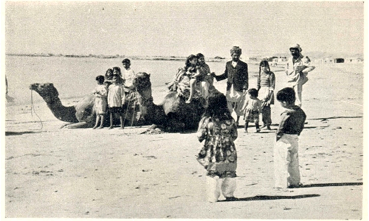
Families enjoy a camel ride on the shores of Clifton Beach in the 1950s. A mammoth shopping mall stands at this very spot today.
A Rickshaw driver on Frere Road heading towards the Clifton Beach in 1965 after that year’s heavy monsoon downpours and a tidal wave which hit Karachi’s coastline.
Picnicking at the Clifton Beach in the early 1970s.
The Clifton Beach/Sea View in 1982. Town houses and apartment blocks began to emerge here in the early 1980s.
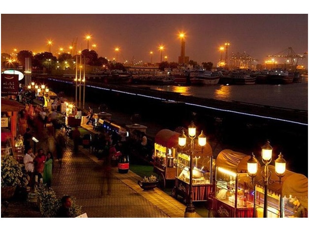
The Clifton Beach/Sea View today. It has become a bustling recreational, commercial and residential expanse.
Group of friends take a stroll on the Clifton Beach. A few meters away is a gigantic shopping mall.
The main Clifton Road in 1901.
Clifton Road in 1975.
Clifton Road today. It has become one of the busiest roads in the city. Tall shopping malls and apartment blocks have continued to appear along its path.
An old painting of The Mohatta Palace surrounded by shrubs and other coastal vegetation. The palatial house was built in 1927 by a businessman as a summer retreat close to the Clifton Beach. In 1964 it became the home of Mrs. Fatima Jinnah. She was the sister of Pakistan’s founder, Muhammad Ali Jinnah.
The Mohatta Palace today. It was locked up and ignored after Ms. Jinnah’s demise in 1967. In 1995 it was restorted by the Sindh govornment and turned into a museum.
A mangrove forest near the sea in a virgin area of Clifton.
Clifton’s popular Boat Basin area. It was built over a large mangrove forest. The area is famous for its restaurants, cafes and 24/7 eateries.
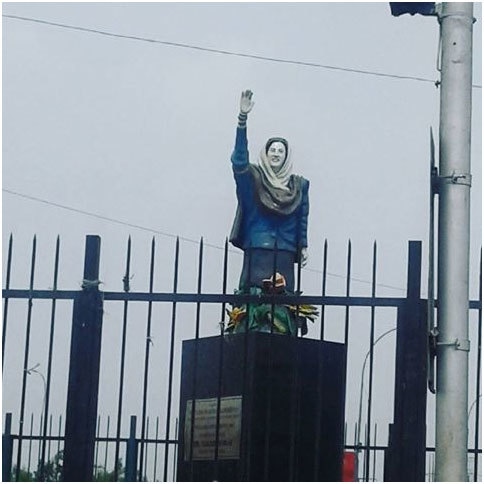
Statue of former Pakistan Prime Minister, late Benazir Bhutto, at a park in Boat Basin. Her home (Bilawal House) too is in the same area.
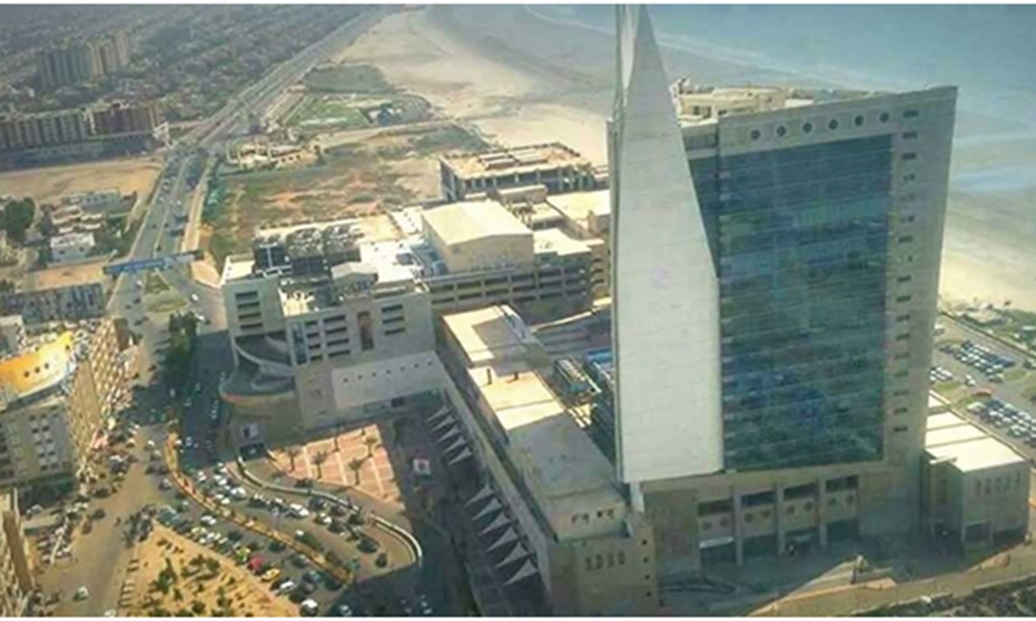
Pakistan’s tallest building (the ICON Tower) being built in the New Clifton area.
Rati Lines, a low-income area in Clifton which has been growing ever since the 1970s. Most residents of the locality work as cooks, drivers, guards and maids in Clifton’s many bungalows and apartments. The area was first settled by roving gypsies in the late 1960s. The locality stands behind Bath Island.
DHA
Defence Housing Authority (DHA) was first established in the 1950s as a cooperative housing society. It is one of the best planned and maintained areas of the city. Its boundaries merge with Clifton and like Clifton it too is an affluent locality.
DHA is mostly a ‘posh’ residential vicinity, but over the years pockets of commercial zones have also sprung up. So have some low-income areas which are populated by those serving as help and labour in DHA’s bungalows.
1975 photo of the turning in Clifton Road which leads to DHA Phase 2 and 4.
DHA today.
Entrance of the DHA Golf Club.
Road leading to DHA Creek Club
Restaurants by the sea in DHA.
Expensive apartment blocks have begun to come up in DHA. This is one of the largest in the area (Creek Vista).
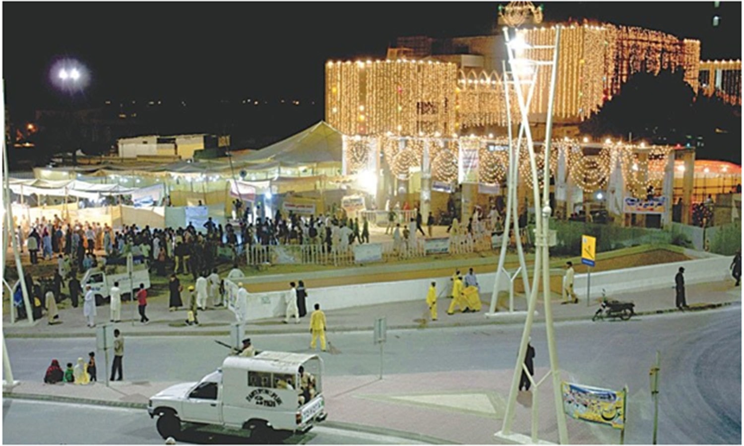
DHA’s famous Taiba Mosque (also called Gol Masjid). It was built in 1969.
Enjoying a smoke at a ‘Sheesha Bar/Café’ in DHA.
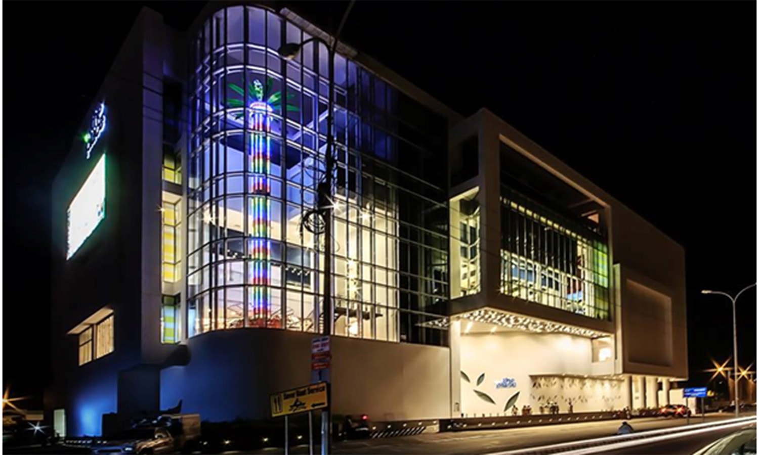
The largest multiplex cinema in Karachi stands in DHA Phase 8. Till even the early 1970s, the area on which this building stands was under sea water.
The Zamzama Park: DHA’s largest public park.
The biggest low-income area in DHA is the Neelum Colony. The land on which it is built was allotted by the government in the 1970s to construct low-income housing for laborers who had to travel long distances to work in Clifton and DHA. High crime and drug addiction rates have often troubled this locality
Queen’s Road/Mai Kolachi/Karachi Port
The Queens Road is an old Karachi locality which runs along mangrove forests of Karachi’s coast line. It is famous for three main landmarks: The Karachi Boat Club; the Beach Luxury Hotel; and the Native Jetty Bridge. It is also an affluent residential area. The wide Mai Kolachi Road connects it with Clifton.
The Native Jetty Bridge in 1957. It begins where Queens Road ends. It was built in 1954. It connects the city to the Karachi Port.
The Native Jetty Bridge in 1979. Till the early 1970s, this bridge was also an infamous ‘suicide spot’ for heartbroken Romeos and Juliets.
The Native Jetty Bridge today (Pic: Irfan Sattar).
Locals and foreigners wine and dine at a restaurant at the Beach Luxury Hotel in 1969. The hotel was built laterally to a mangrove forest in the Queens Road area.
The Beach Luxury Hotel today.
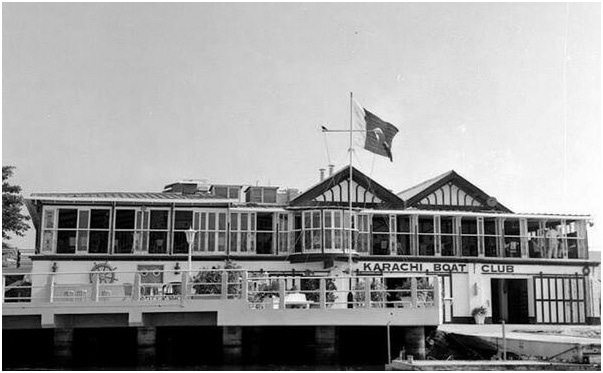
The Karachi Boat Club (KBC) in the 1950s. It was built in the 19th century along the same mangrove forest.
The KBC in the 1970s.
KBC today. The waters and mangroves which run alongside it have become extremely polluted.
The Karachi Port in the 1850s.
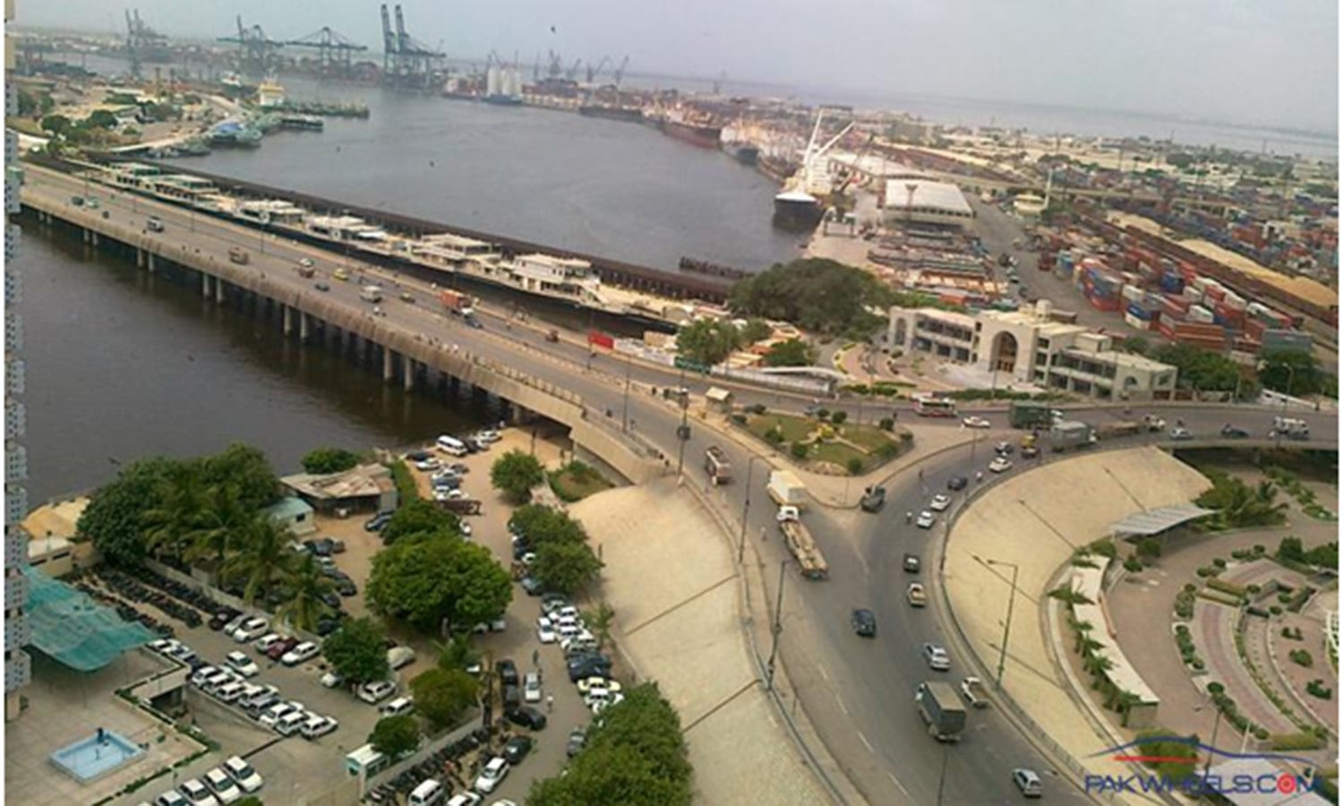
The Karachi Port today.
Karachi Port view at night. (Pic: Ali Raza Khatri)
The Mai Kolachi Road which connects Clifton with Queens Road. Mai Kolachi was laid over a vast mangrove area in the early 1990s. It is named after Karachi’s old appellation, Kolachi (which was changed to Karachi in the late 1900s).
The famous recreational area, Port Grande. It is built on the waterfront of the Netty Jetty Bridge.
Port Grande in the evening.
Manora
Manora is one of the oldest areas of Karachi. It was here where the Greek commander, Nearchus, came across native fishing villages almost 2000 years ago. It is also one of the areas from where the British navy invaded Karachi in the 1840s.
Manora in 1850s.
Manora today, with its famous lighthouse and old church.
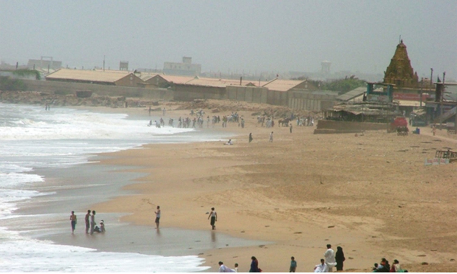
The Manora Beach. An ancient Hindu temple stands here as well.
Karachi Fish Harbour
Karachi Fish Harbour was built in the 1950s. Over 90 percent of Pakistan's fish and seafood catch and exports pass through this harbour.
A British expat and his son pose for the camera with their catch at the Karachi Fish Harbour in 1957.
The harbor today.
Cranes pull out a 40-ft ‘whale shark’ from the waters of the harbor.
Boat-building is still considered to be an art by many who reside in the area around the harbor.
Keamari
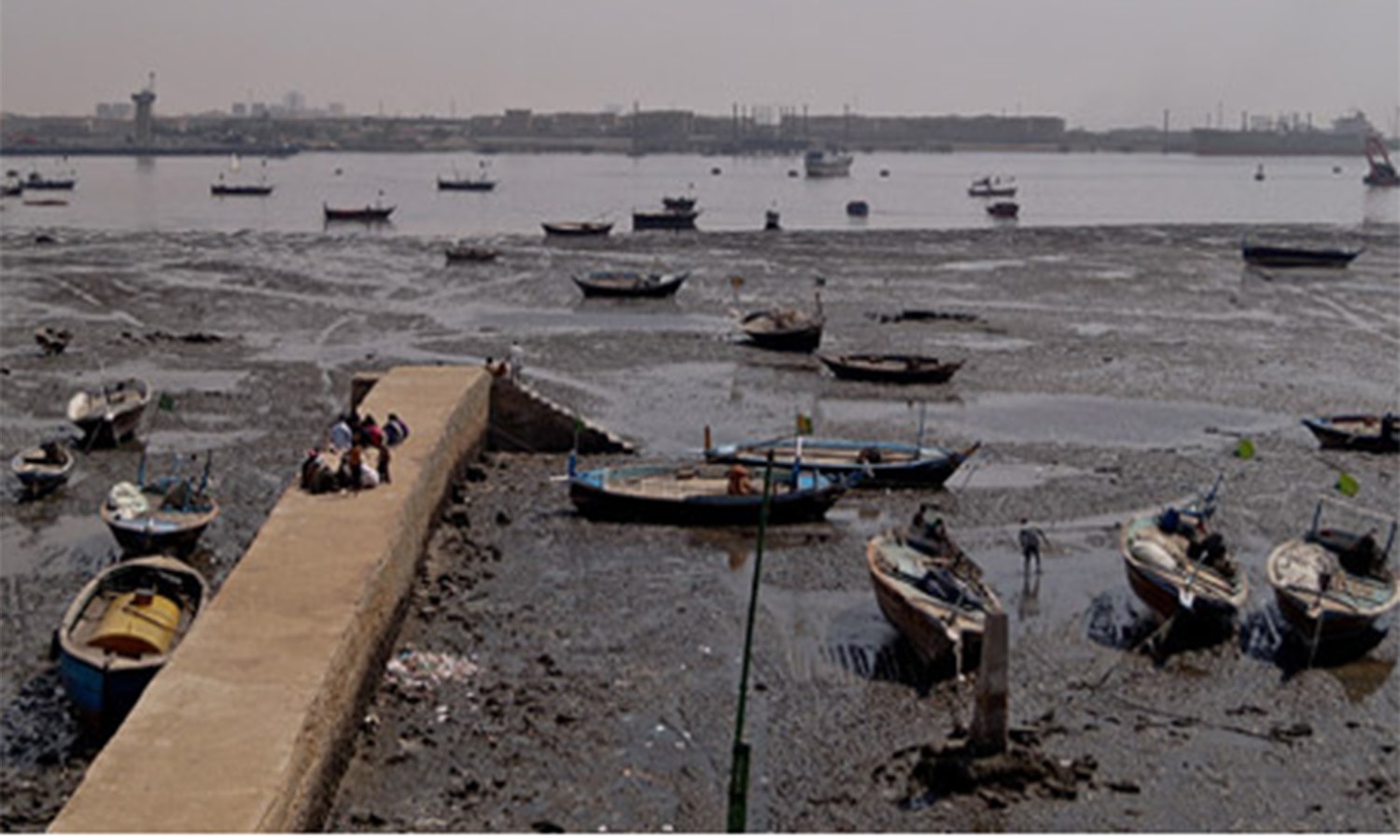
Like Manora, Kimari too is one of the oldest areas of Karachi along the city’s main coastline. However, it is thickly populated and the quality of sea water here is one of the worst. Most of the inhabitants are fishing folk. Many also own old motorboats which they hire out to tourists and visitors.
A recreational activity called ‘crabbing’ has been popular here for decades. Tourists and people from other areas of Karachi (and Pakistan) hire boats (mainly in the evenings) and go ‘crabbing’. Crabs are caught and then cooked and eaten on the boat.
A tram station in Keamari in the 1940s.
Keamari today.
Tourists enjoy a boat ride in Keamari in the late 1960s.
Boats for hire to go ‘crabbing’ in Keamari waters.
The polluted waters of Bhit Island near Keamari.
The Beaches
Karachi has a long coastline and a number of beaches. Its most commercial beach is in Clifton (which is also one of the most polluted). However, even in this day and age, Karachi is still famous for having some of the most naturally beautiful beaches in the world.
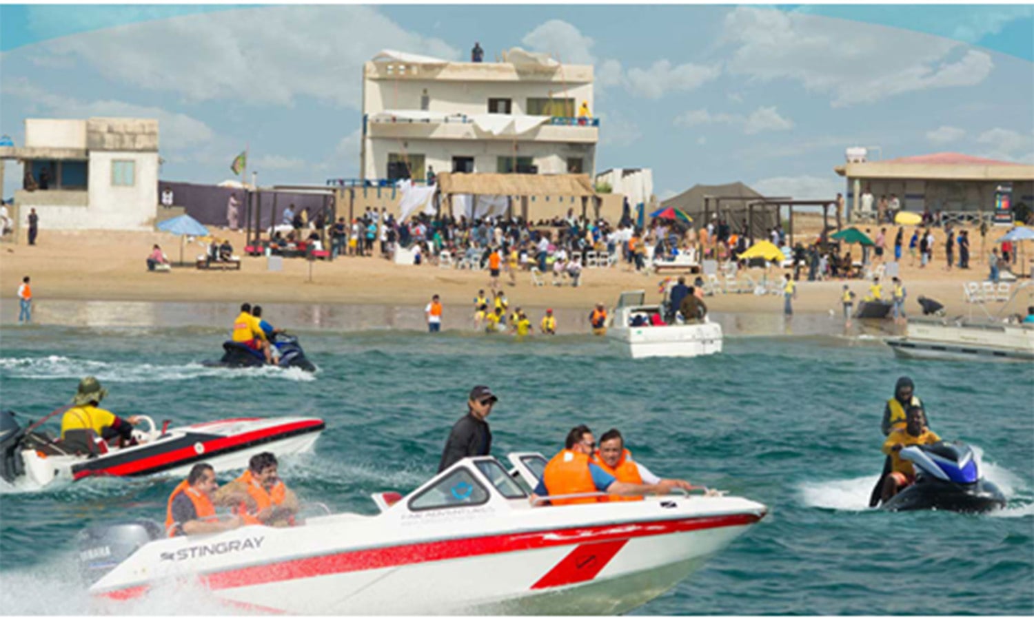
A watersports event at the popular Hawksbay Beach. It is one of Karachi’s most popular resorts, even though it has begun to be encroached upon by a rapidly growing housing scheme in the area.
The Sandspit Beach is famous for its calm waters, rocky formation, and for being the nesting ground of Green Turtles.
The Paradise Point Beach is famous for its rough waters, especially around an ancient natural rock formation which till even recently used to have an arch. The arch eventually came apart a few years ago.
Between Hawksbay and Paradise Point is the ‘French Beach.’ It is mostly frequented by the affluent members of the society who own all the ‘huts’ here.
The serene Cape Monze Beach (aka Ras Mauri). It is located near the Hub River which meets Karachi’s sweet water needs.
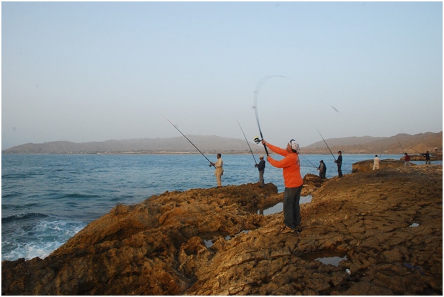
Men fishing at the Mubarak Village Beach.
Whales and dolphins are often spotted in the waters of the Mubarak Village Beach. This whale was recently spotted here. (Pic Dawn TV)